Multi-Mission Geographic Information System
Spatial Data Infrastructure for Planetary Missions
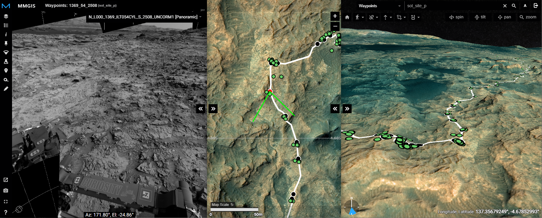
Features
- Web-based mapping interface
- 2D slippy map
- 3D globe with tiled height data
- Image viewer capable of showing mosaics with targets
- 5 fully customizable layer types
- Easy to use CMS
- Multi-user vector drawing
- Elevation profiler
- Custom projections
- Tiling scripts
- COGs
- TiTiler
- STAC
- And so much more…
Contacts
Dr. Fred J. Calef III - fred.calef@jpl.nasa.gov
Tariq K. Soliman - tariq.k.soliman@jpl.nasa.gov
Or join us on Slack